

You can find on this page the Argentina airports map to print and to download in PDF. The map of Argentina airport presents details of location and international airports of Argentina in South America.
The Argentina airports map shows location of airports in Argentina. This airports map of Argentina will allow you to determine which airport you will used to leave or arrive in Argentina in South America. The Argentina international airports map is downloadable in PDF, printable and free.
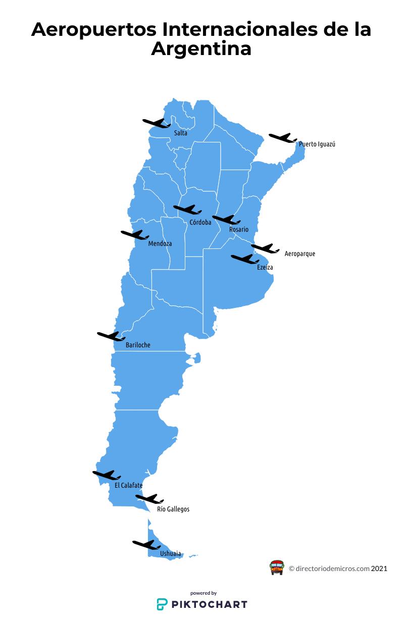
Ministro Pistarini International Airport is the largest and busiest Argentinian airport. It is also the main airport and one of three airports serving the capital city of Buenos Aires. Also known as Ezeiza Airport, it is a primary hub for several airlines – Aerolíneas Argentinas, Austral and LATAM Argentina as you can see in the Map of Argentina airports. Pistarini Airport handles the majority of the international flights to Argentina. Airport is located about 23 km southwest of Buenos Aires. There are three airport terminals, handling international and domestic arrivals. Aeroparque Jorge Newbery is the second among busiest Argentina airports. Together with Ezeiza Airport, it serves the broader Buenos Aires area. AEP airport is the closest airport to Buenos Aires, located in Palermo district, just 2 km northeast of the city center. It serves mostly national flights and international routes to Uruguay.
Cordoba Airport is also known as Pajas Blancas Airport and by its full name Ingeniero Aeronáutico Ambrosio L.V. Taravella International Airport. It is an international airport located in Cordoba, some 10 km north of the city center as its shown in the Map of Argentina airports. Airport is a hub for several budget carriers such as GOL Airlines, Flybondi and JetSmart. It also handles flights by major airlines like Aerolíneas Argentinas and Austral. Mendoza Airport is the fourth busiest Argentinian airport. It is also known as El Plumerillo Airport and Governor Francisco Gabrielli International Airport. Airport is located in Mendoza city, about 9 km north of the center. LATAM airlines, Flybondi and Austral all have daily flights from and to the airport. Mendoza airport is the optimal choice for anyone travelling to the Cuyo region and destinations like San Luis, San Juan and Uco Valley.
San Carlos de Bariloche Airport serves the city of the same name in Rio Negro province as its mentioned in the Map of Argentina airports. It is another international Argentina airport, located 14 km east of the city. LATAM, Aerolíneas Argentinas and LADE airlines all operate at the airport. To reach the city from Bariloche Airport, passengers can take public buses, airport shuttles and taxis. Airport is convenient for anyone going to Rio Negro locations like Nahuel Huapi National Park, Villa La Angostura and El Bolson. El Palomar Airport is the third airport serving the greater Buenos Aires area. Airport is located in El Palomar city, about 20 km west of the Buenos Aires city center. EPA airport is a good choice for budget travelers, as Flybondi and JetSmart have regular flights to the airport. Iguazu Airport is an international airport located in the city of Puerto Iguazú. Airport’s full name is Cataratas del Iguazú International Airport. Locals call it Mayor Carlos Eduardo Krause Airport.